I awoke from a dream at 3:00 AM, feeling excited to get another long day started. Oof, the body was not feeling fresh. But I was riding by 3:43am. The climb up out of Aliso Canyon was on a steep, narrow, bumpy off-camber singletrack that Erin, the route creator, insists is rideable. Indeed, if I were fresh and didn’t have a 40 lb. bike and I had more than 90 minutes of sleep, it probably would be. But it was really nice to just hike up it and save my rear. There was plenty of pedaling to come.
Next up, the Sierra Madre road follows a spectacular ridge line. The sun had peeked out just before hitting it. I could not resist taking a sunrise montage with my dying iPhone:
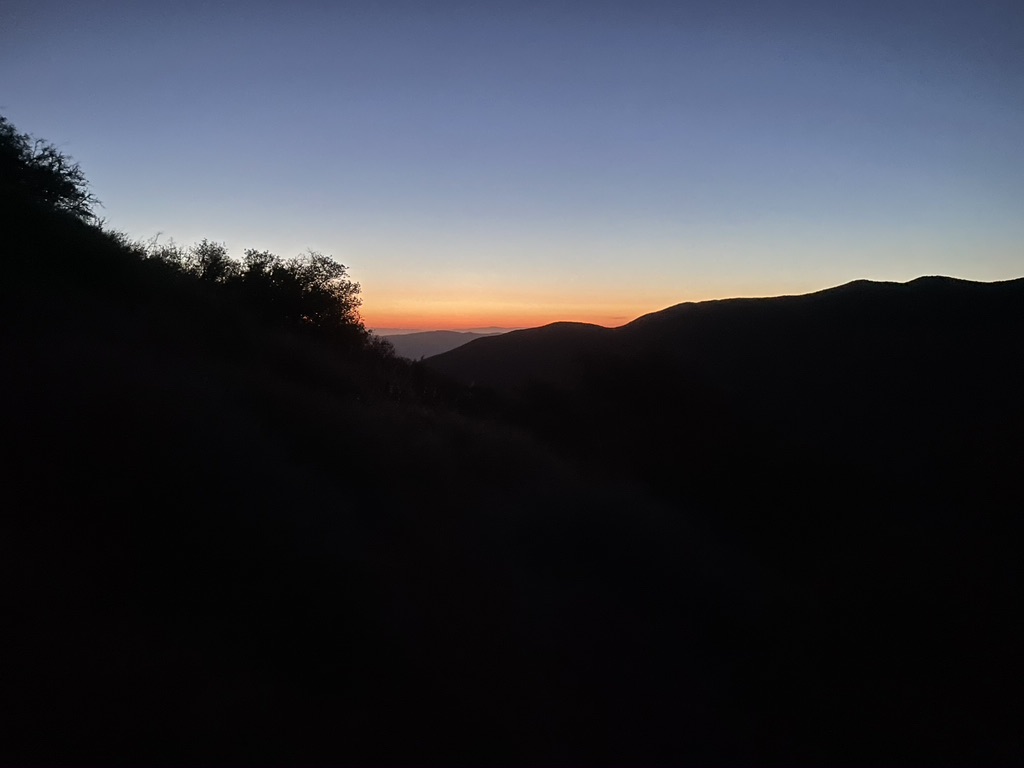
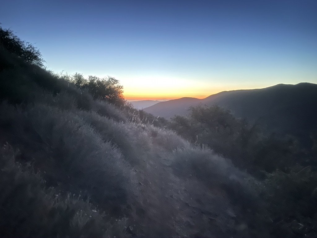
By 5am, the sun had barely peeked out and I had already ditched all of my layers.


On the previous day, my stomach was really upset in the morning, so today I opted out of coffee, which was completely uncharacteristic of me. But I had a secret weapon – a packet of some sort of powdered caffeine that our sponsored BASE jumping friend gave to us a long time ago. It was like pop rocks in my mouth – very weird. Then I settled in for a 15 minute power nap, setting my alarm, and lying down on the side of the dirt road with my pack as my pillow. I felt amazing! The caffeine powder didn’t have any more caffeine than a cup of coffee, and it didn’t make me feel jittery. Gradually my mood and alertness lifted, like coming out of a fog.
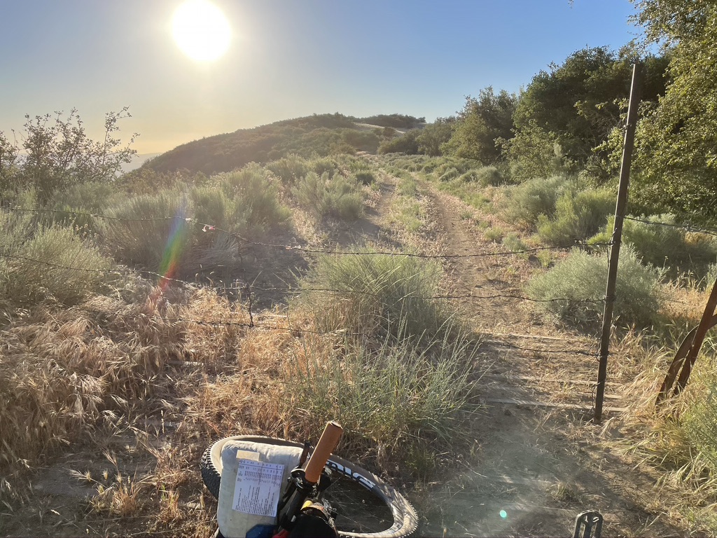
There was a pretty gnarled old barbed wire fence on the road this time that I didn’t remember from last time. It took a while to work out how to open it up, after having a brief worry that I’d missed a turn somewhere.
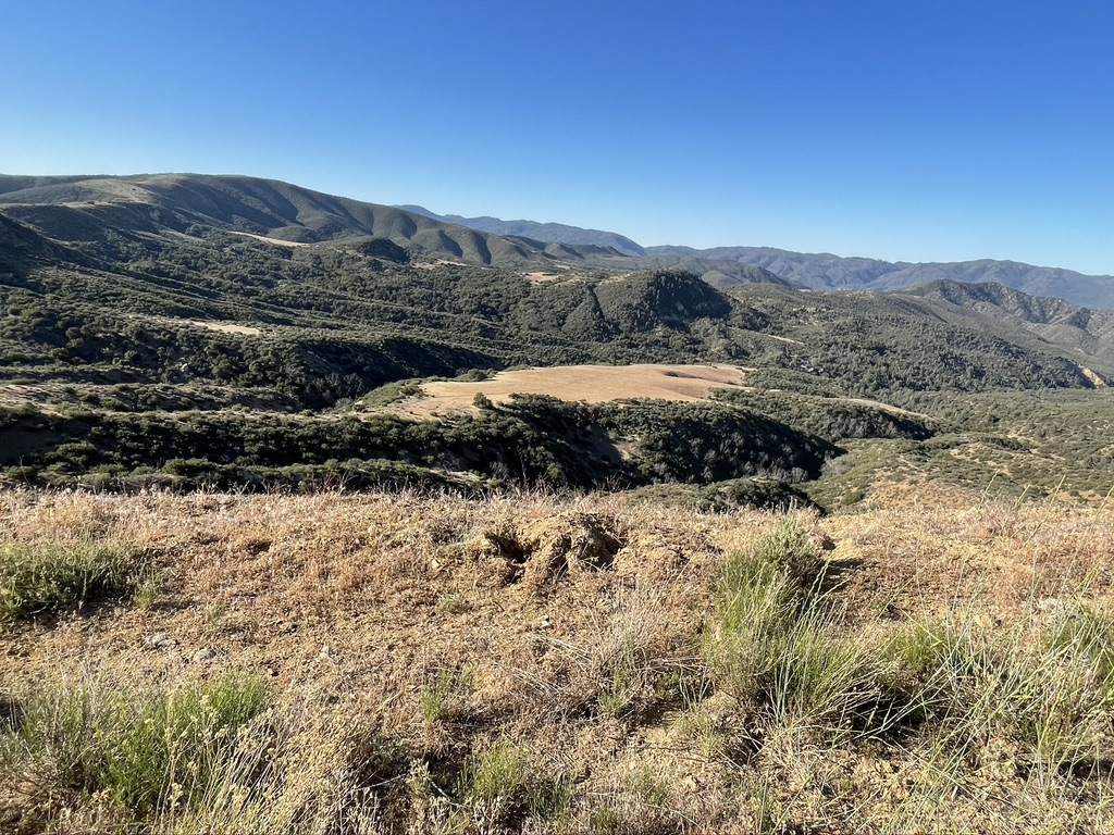
Next up was the beautiful Painted Rock area. This area was definitely a powerful spot in the Earth’s energy field. It is a site of significance to the people who inhabited this area long before Europeans. There is more explained here: https://www.cyark.org/projects/chumash-painted-cave/in-dept
At the Painted Rock campground, there were friendly campers there who offered me coffee! I politely refused. But they had stocked the outhouse with paper and wipes for which I was grateful.
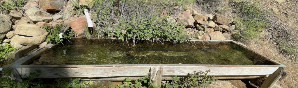
This year, I actually rode out to check out the old cabin nearby, which is hidden from view from the road. There was a spring-fed trough full of cool water for filtering. I wasn’t relying on it, but it sure was nice to have the extra insurance. This was a really dry year.
After Painted Rock, the landscape features other-wordly islands of smooth weathered sandstone amidst the grasses, where wind and rain had cut small holes and divots. I imagined that they too must have had significance to the indigenous culture.
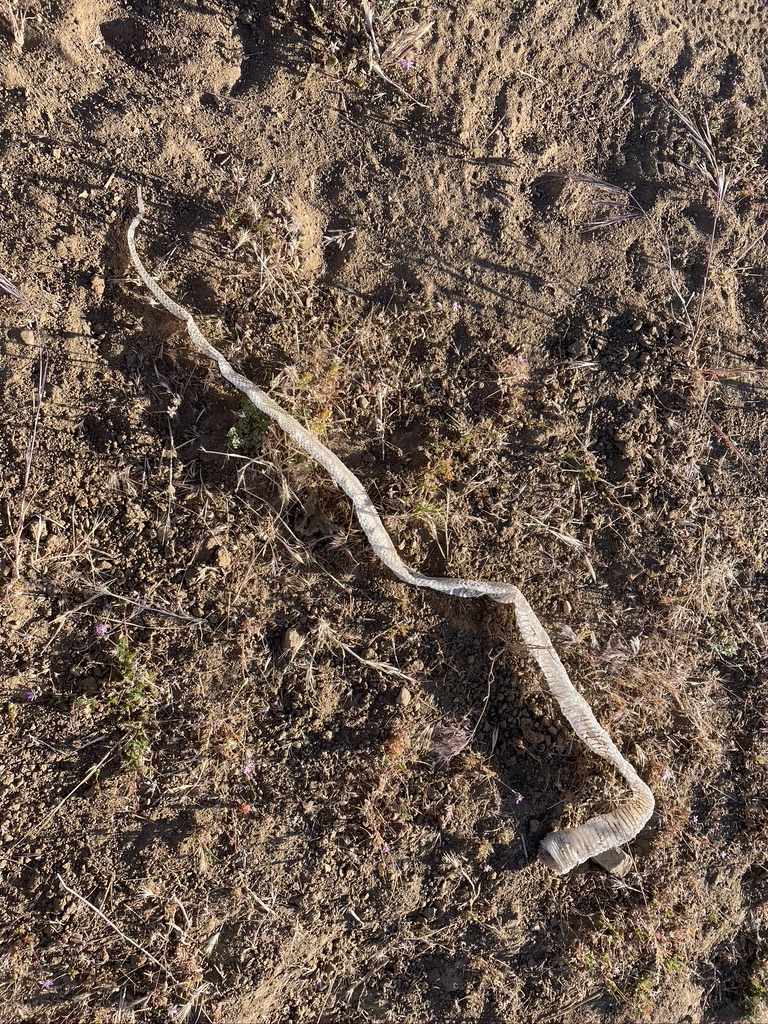
I didn’t take photographs of the rock islands this year. You’ll just have to go and see for yourself! But I HAD to stop and take a photo of this shed snake skin!
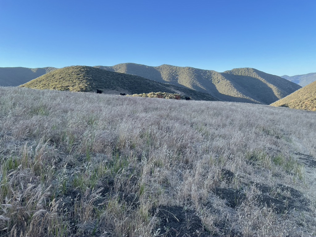
Like in all of our national forest land, there was a bunch of cattle grazing up here.
This year, the fire road was in much better shape than last. But it was heating up significantly and there wasn’t any shade. It was a relief to get to the shady Chokeberry spring oasis, where I would have to fill up enough to last basically until the Santa Inez river on the climb up to the very last downhill.
Up along forest road 9N11, I got to the top of a ridge and suddenly there was a sound of something big crashing through the bushes, just on the embankment above where I was on the fire road! I stopped, and out popped a big bear! He plopped onto the fire road in front of me and bolted really fast away from me as if I was the scariest thing he’d ever seen. My BO must have been pretty bad by then, and my I9 hub is ridiculously loud. Poor guy. I watched as he deftly bound up the other embankment further down the road into the safety of the brush and trees. I guessed he was a male because he looked full grown, and there were no cubs present. Sadly it all happened too fast to get a photo. But there were a ton of bear tracks all up and down this section of road.
After a long switchbacked dirt road descent, the route diverged from last year, and went down the really fun Camuesa fireroad that turned into this crazy wash with a lot of erosion where a road used to be. The route was supposed to go along the Santa Inez river canyon, but the river was completely dry. It was HOT down there, I mean. really, oppressively hot. The high on my Garmin for the day was 104, but it felt hotter. There was nobody around and almost no shade. In fact, I hadn’t seen any humans since Painted Rock. I stopped frequently to cool down and douse water on my head and arms and legs. Luckily I brought enough.
Finally, there was a shady river crossing that had water! It was getting low, and was a bit slimy in places, but flowing in others. Phew. Another chance to cool off. I spent more time splashing water on me.
Only one big climb left now!! I was stoked! The day was getting late, and temps seemed to be going down a little bit. More and more I could feel the ocean breeze until finally I reached the crest of the ridge looking down over the Pacific! Ahhhhh – instant relief! It was almost chilly!
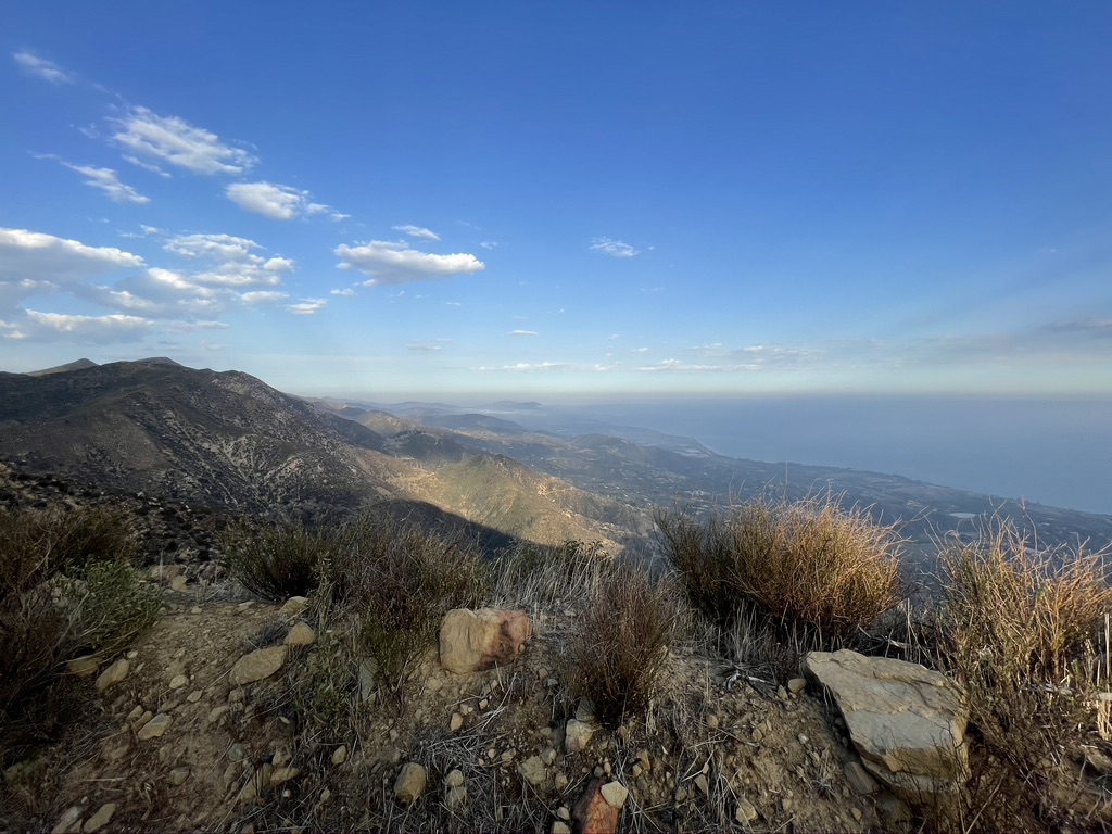
I had to stop to put on a layer! The descent down Romero Canyon was mostly fun, but it was a bit bone-jarring, and my hands were toast at that point. Then the little neighborhood singletrack that I hiked up on Day 1- Fearing Trail – was SO MUCH MORE FUN in the dh direction.
Then it was just smooth pavement to the downtown area! And just as the sun went down, I reached the finish!!!
Prologue
Shout out to “Team Gnarly Shredz”, who were texting me at the end! It was really nice to have had the chance to come down here in March, meet the locs, and make a bunch of new friends.
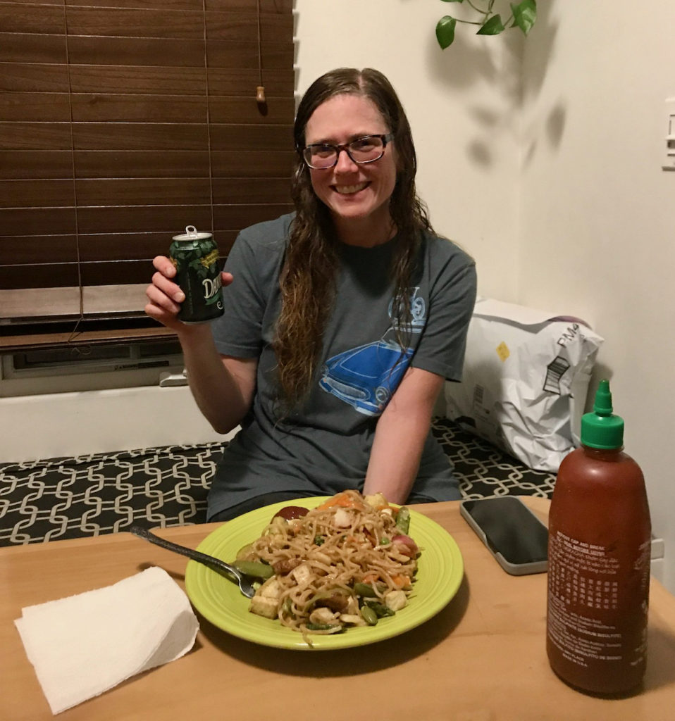
But I was done in more ways than one. I was planning to just google up a hotel, google up some vegan food, and tuck in for the night, but these tasks were like nuclear physics in my current state. Erin offered couch space and to heat up a really nice stir fry noodle meal, and it just made everything so easy. I could not refuse his family’s kindness.
I fumbled through finding my way back to where I parked my truck. I finally got there, and had such a hard time untangling my Garmin that I just had to grab my pocket knife and destroy the tether that held it onto my bars. I had wet shoes and socks and needed to get out of my chammy pronto. Man, it took way too long to get out of there and find Erin’s house. It was probably quite late by then. Driving the 3-ish miles required all of my concentration. Parallel parking was pretty hilarious. Anyway, I am so grateful for Erin and his wife’s generosity!
Stats for the day:
- 92 miles
- 10,371 ft el gain
- 13,481 ft el loss
- 6,441 ft max elevation
- 348 ft min elevation
- 3,625 calories burned
- 16:38:51 total Time
- 13:32:27 moving time
- 48.2 °F min temp
- 104 °F max temp
I completed the route in 2 days, 14 hours, 15 minutes.
My Strava:
Here is the route website: https://tourdelospadres.weebly.com/
I would highly recommend completing it before Memorial Day weekend when I did it, but sometime after the snow melts in the higher elevations.